When every seat gets home safe

Safer routes, and the records to prove it.

Live bus tracking, driver coaching, and digital DVIRs give districts and parents confidence.

  • Real-time bus tracking across every route
  • Driver coaching and digital DVIR workflows
  • Camera integrations for incident review
City traffic along a passenger route

Student Transportation

Visibility, accountability, and parent confidence

Manage K-12 buses proactively: routes, safe driving, maintenance, and inspections in one place.

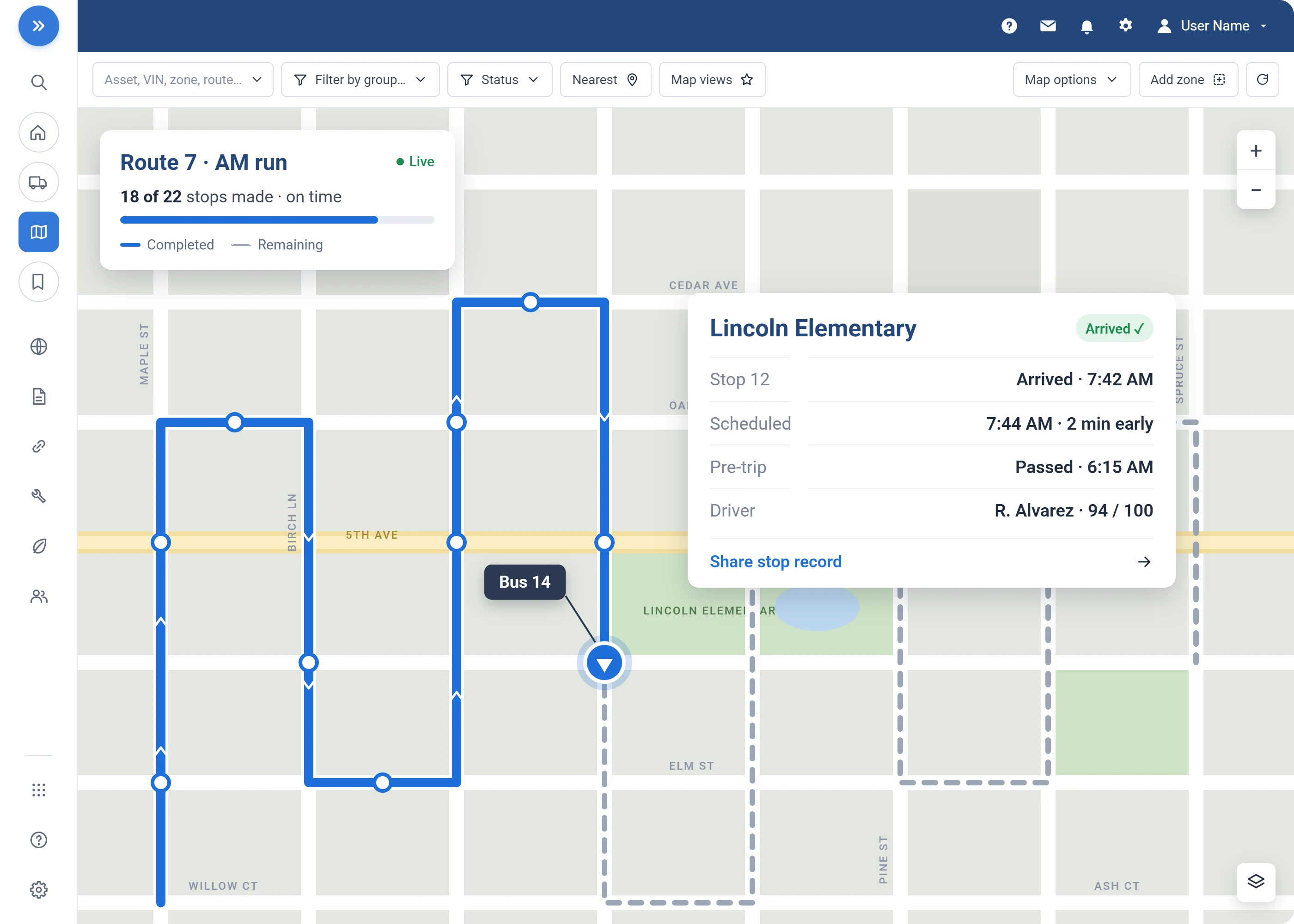
  • Stop-level geofences: every arrival and departure, logged
  • Live bus position: every route on one dispatch map
  • Digital DVIR inspections: photos routed straight to the shop
  • Seatbelt scoring: tracked with speeding and harsh braking
  • Maintenance from engine data: service scheduled before breakdowns
  • Routing integrations: ridership and student systems
School transportation safety dashboard

What Changes

What your operation gets out of it

Fewer incidents

Enhanced visibility and driver coaching reduce risky behavior.

See it in MyGeotab
Real MyGeotab widget: safety scorecard
Lower operating costs

A fault caught early in the shop costs less than a breakdown mid-route.

See it in MyGeotab
Real MyGeotab widget: maintenance reminders
Higher parent confidence

Real-time visibility builds trust in every trip.

See it in MyGeotab
Real MyGeotab widget: live position

Route Truth

Every stop is a checkpoint, not a guess

A geofence on every stop logs when each bus arrived and left. "Did the bus come?" becomes a lookup, not an investigation.

Planned versus actual puts detours and early running on a report, not in a complaint.

The data is handled like it is about children, because it is

Student data lives on MyGeotab, a FedRAMP Authorized and ISO 27001 certified platform with 24/7 security monitoring.

Role-based access keeps every record limited to the staff who need it.

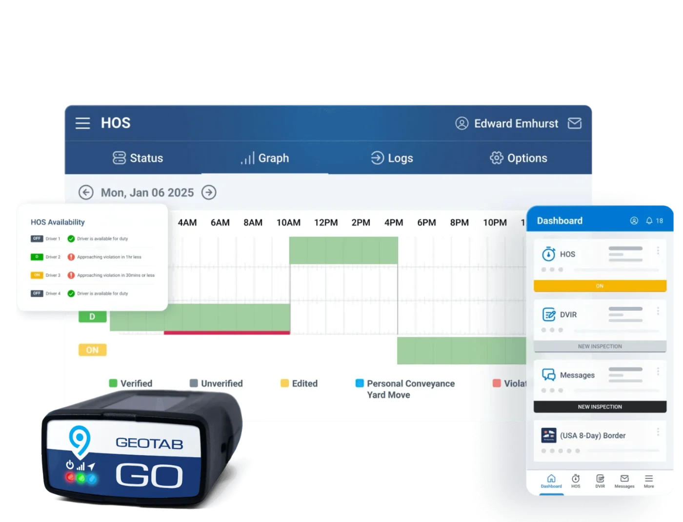
Geotab Drive app inspections and driver workflows

Geotab Drive

DVIRs and stop logs in the driver's hand

Pre- and post-trip inspections with photos attached, beside the same stop-by-stop record dispatch sees.

Built for the route home

What Geotab sets up for student transport

Parents want the bus on time and driven well. Districts want the records. Same system.

Collision Risk, beyond scorecards

Geotab's Collision Risk model, the only one built on 6M+ connected vehicles, flags at-risk drivers even when scorecards look clean, and is 20% more effective than a scorecard alone (Geotab Safety 201, 2026).

On-time performance

Route timing tracked day after day, stop by stop.

Footage tied to the trip

When a question comes in, dash camera video lines up with the exact trip record.

Answers for parents in seconds

Dispatch pulls exact arrival and departure times for any bus and stop.

Bought without an RFP

Districts purchase on Sourcewell 102924-GEO or NASPO ValuePoint MA3695.

Set up and supported by GPSFMS

One team from install through every policy change.

Questions

People transport FAQ

Is this suitable for K-12 and transit?

Yes. Location, routing, and safety tools support student and passenger transport with accountability for parents and administrators.

Can we monitor driver safety?

Safety scoring, alerts, and AI cameras support safe driving on routes carrying passengers.

How do public agencies buy it?

Through cooperative contracts Sourcewell 102924-GEO or NASPO ValuePoint MA3695, with no RFP required.

Can parents track the bus themselves?

MyGeotab is a staff-facing system: dispatch and the transportation office see live positions and answer parent calls with exact times. Whether to offer parent-facing bus visibility is a district policy decision, and there are Marketplace options if you choose to. We will walk you through what other districts do.

How is driver data used? Our drivers are worried about being watched.

The honest answer: the data documents driving, and districts decide what to do with it. The pattern that works is coaching on trends (not single events), praise for the quiet majority who drive well every day, and clear policy set before installation. The same records exonerate drivers after complaints and crashes far more often than they implicate them. Where drivers are represented, bring the union in early.

How long is the data kept?

Retention is configurable by your administrators to match your district's records schedule. Like any other district record, telematics data should be assumed subject to records requests.

“We know exactly where our shuttles and buses are on your interactive, second-to-second maps. Not sure how we ever operated without it.”
Charlotte Douglas Airport, Charlotte, NC

Ongoing support for safer, smarter transportation

We configure rules and reports to your district policies, train staff, and deliver dashboards that demonstrate safety, reliability, and cost control.

Prefer to talk? Call (877) 771-2236. No spam, ever.

We reply within one business day. No obligation, no spam. Prefer to talk? (877) 771-2236