Government Fleets

Your fleet, connected, compliant, and mission-ready

See every vehicle in real time, coach drivers before a crash, and back every budget request with numbers instead of estimates.

  • 26+ years in business, serving fleets since 1999
  • U.S.-based white-glove support with calls answered in minutes
  • Ranked #1 commercial telematics provider worldwide (ABI Research, four consecutive years)
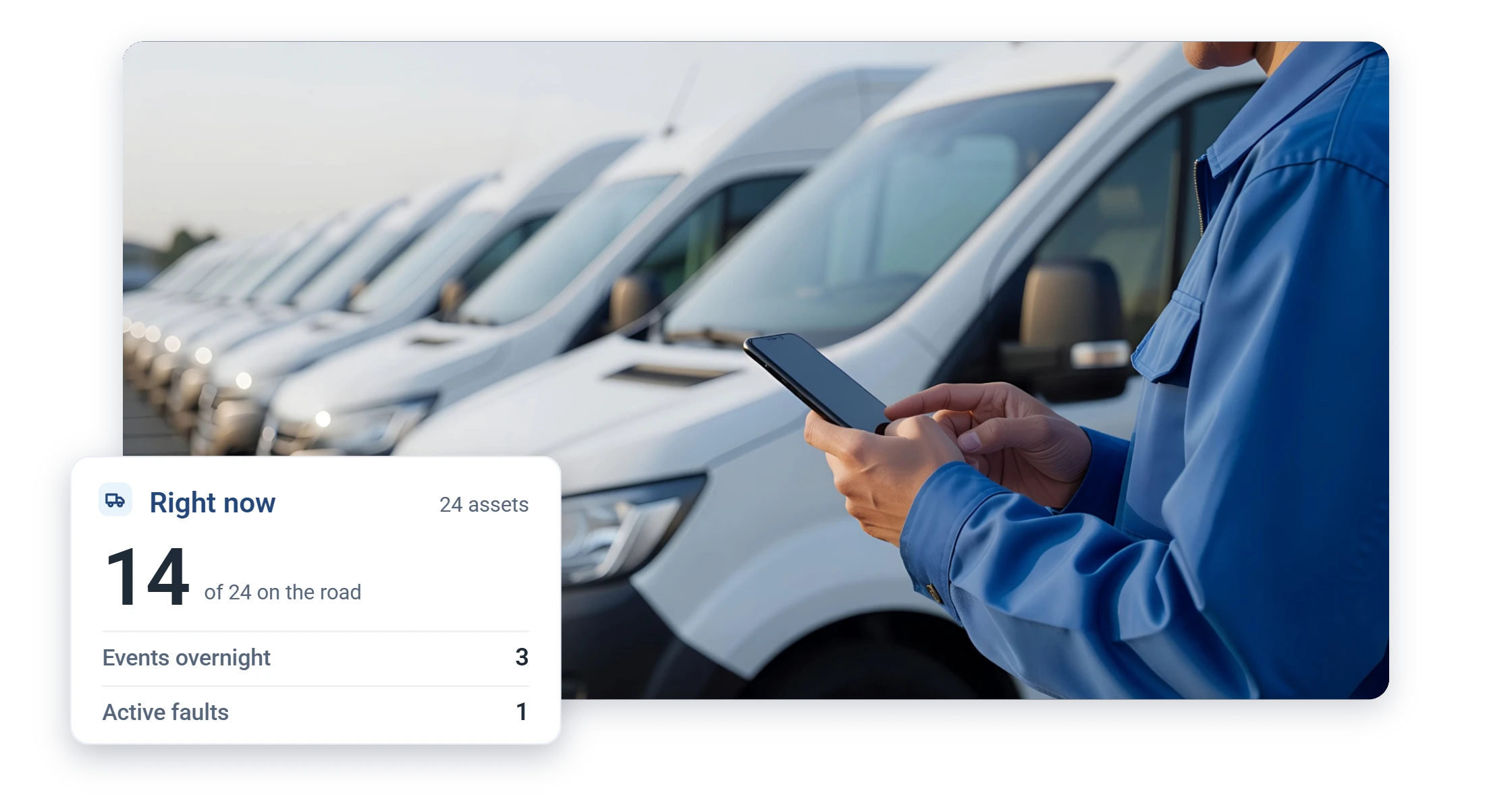
MyGeotab dispatch map locating a fleet vehicle near a hospital zone
6M+Vehicles and assets connected on Geotab worldwide
2,900+Public-sector customers on Geotab (Geotab, 2024)
500+Solutions in the Geotab Marketplace

One Platform, Every Department

Built for government fleet performance

Standardize safety, reporting, and uptime instead of running a different system in every department.

  • Live fleet visibility with trips, stops, and geofences
  • Safety scoring and risk insights to coach proactively
  • Leadership-ready reporting for budgets and audits
  • Fleet health intelligence to reduce downtime
  • Open platform integrations that scale over time

Ready to see it in action? Request a free demo and we will tailor it to your department, or choose a program below.

Programs

Choose your government program

Cooperative Contracts

The purchasing part is already done

You do not need to write an RFP to buy this.

Sourcewell 102924-GEO

National cooperative contract, current through April 2029.

What is on the contract

Cameras, asset tracking, and analytics on the same paper.

NASPO ValuePoint

A second path for state agencies.

In practice

Reference the contract number, we quote against it.

Security your IT department can verify, not just read about

  • MyGeotab is FedRAMP Authorized: the cloud platform is authorized for U.S. government workloads
  • ISO 27001: certified information security management
  • FIPS 140-3 validated devices: the GO device family carries certificate #4875, the current cryptographic validation standard
  • 24/7 security monitoring of the platform

Full credentials: FedRAMP authorization and data security, one page over. Bring your IT team to the demo; we would rather answer the hard questions before you buy.

Because pricing is pre-negotiated on the cooperative contract, quotes are quick to produce and easy to defend in an audit. Full detail on the procurement page.

Modules Included

The same login runs the plow yard, the police garage, and the bus lot

MyGeotab ships with modules government fleets actually use, not add-ons to be quoted later.

Public Works module

Route completion by street segment, so plowing and sweeping are documented as they happen.

Citizen Insights

A WCAG-compliant public service map residents can check during a storm, with a configurable 15-minute update delay for privacy and English, French, and Spanish support (Citizen Insights User Guide, 2024). Detail on the Public Works page.

Clean Truck Check

For California fleets, compliance records stay organized and ready when CARB reporting windows open.

HOS and DVIR

Hours-of-service and digital vehicle inspections through Geotab Drive, with 100+ HOS rulesets for the U.S. and Canada.

Sustainability Overview

Fleet emissions intensity and tailpipe emissions tracked monthly, with an exportable Excel report for council and state reporting (Sustainability Overview User Guide, March 2026).

Maintenance

Fault codes ranked by severity and breakdown risk, work orders tied to the defect that caused them.

And when the safety program needs a carrot instead of a stick: Geotab Vitality rewards safe driving with real incentives, fully voluntary, no cameras required. Municipal fleets running driver-rewards programs have seen measurable drops in predicted collision risk (Geotab-reported).

Built for public service

What your agency gets on day one

Procurement, security, and accountability are solved problems here. This is the government package.

Sourcewell and NASPO

Buy through competitively solicited cooperative contracts.

FedRAMP Authorized

The checkbox your IT security review looks for, already checked.

Proven at scale

Trusted across public works, safety, and transit fleets nationwide.

Public accountability

Service and response documented for constituents and councils.

Every department

Public works, safety, and transport fleets on one platform.

U.S.-based support

A team that knows your fleet, not a ticket queue.

Questions

Government fleets FAQ

How do agencies buy Geotab through GPSFMS?

Through Geotab's cooperative contracts. Reference our Sourcewell contract 102924-GEO, or NASPO ValuePoint for state agencies, and we quote against it, no separate solicitation required.

Is it secure enough for public agencies?

Yes, verifiably. MyGeotab is FedRAMP Authorized for U.S. government workloads and ISO 27001 certified, GO devices carry FIPS 140-3 validation (certificate #4875), and the platform runs 24/7 security monitoring. Full credentials are on our data security page.

What government fleets do you support?

Public works, public safety, people transport, and general municipal fleets, with reporting built for accountability.

Is our vehicle data subject to public records requests?

In most jurisdictions, yes. Telematics records generated by a public fleet are agency records, and you should assume they can be requested. The practical good news: MyGeotab makes responding straightforward. Trip histories, reports, and audit logs are exportable, and data retention is configurable by your administrators, so your responses match your records policy instead of a vendor default.

How do employees and unions usually respond?

Honestly: better when it is introduced right. The fleets that succeed are upfront that the data protects drivers as often as it flags them, exonerating them after complaints and crashes, and they set coaching policy before installation, not after the first incident. Where a bargaining agreement applies, involve the union early.

What does the Sourcewell contract actually cover?

Sourcewell 102924-GEO covers the Geotab platform and GO devices, plus GO Focus and GO Focus Plus video telematics, GO Anywhere asset tracking, and Altitude by Geotab analytics. It runs through April 2029, and NASPO ValuePoint is the state-level alternative.

Faster visibility, stronger accountability, dependable uptime

Public works, utilities, public safety, or people transport: we will help you get there.

Prefer to talk? Call (877) 771-2236. No spam, ever.

We reply within one business day. No obligation, no spam. Prefer to talk? (877) 771-2236